Land area covered by forests in Angola
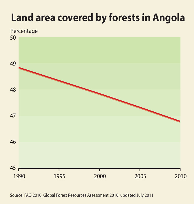
Angola is the most densely forested country in the Basin (FAO 2010), including tropical rainforests in the north. While some Basin states had deforestation rates as high as 2.2%, Angola shows a rate of between 0.1 and 0.2%, although this is estimated as many of the forested areas were inaccessible for a long period. There has been no forestry inventory in Angola since independence in 1975, but the Ministry of Agriculture estimates the minimum reserve at 17.45 million cubic metres of trees, allowing 20 years of rotational annual cuts. The use of forestry plantations has been increasing steadily in Angola, which has the largest forest plantation area in the Basin, together with Zimbabwe (SADC and SARDC 2008). Those two countries are the main exporters of forestry products in the Basin. The area under forest and woodland in Angola has declined at a rate of two per cent between 1990 and 2010 (FAO 2010) as shown in Figure.
Year: 2013
From collection: Zambezi River Basin - Atlas of the changing Environment
Cartographer: This