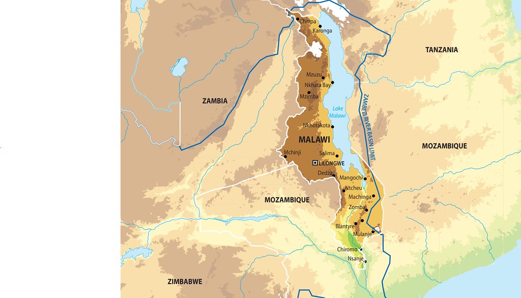
Map of Malawi
Total Area of Country: 118 484 sq km Portion of Country within Zambezi Basin: 110 700 (93.4%) National Population in 2010: 13.9 million Portion of National Population within Zambezi Basin: 13 050 000 (96.67%) Malawi is the most densely populated country in the Zambezi Basin. Its diverse physical features support a variety of flora and fauna. Lake Malawi extends over almost two-thirds of the eastern border area and with other water bodies covers one-fifth of the country’s total area. This extensive water body has a strong influence on the climate which varies from semi-arid to humid (SARDC/Chenje 2000).
Year: 2013
From collection: Zambezi River Basin - Atlas of the changing Environment
Cartographer: This