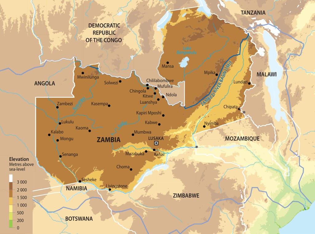
Map of Zambia
Total Area of Country: 752 614 sq km Portion of Country within Zambezi Basin: 577 900 (76.8%) National Population in 2010: 13 million Portion of National Population within Zambezi Basin: 8 517 600 (65.52%) Zambia is a landlocked country resting on a high plateau with a subtropical climate characterized by a single rainy season. Savannah is the dominant ecosystem and covers the centre of the country, separating the rain forest in the northwest from the semi-desert region in the southwest. Along Zambia’s border with Zimbabwe, the Zambezi River flows over the famous Victoria Falls – Mosi oa Tunya in the local Tonga language, “the Smoke that Thunders”. The two countries also share the Kariba Dam, built to generate hydroelectric power and also now a major recreation and fisheries area. Northern Zambia joins the southern end of Lake Tanganyika. Zambia is the source of the Zambezi River, which rises as a small spring in the northwest of the country.
Year: 2013
From collection: Zambezi River Basin - Atlas of the changing Environment
Cartographer: This