We use cookies to imporve your experience. By using our site, you consent to our cookie policy Learn more
arrow arrow_up breadcrumb-chevron-right breadcrumb-home dropdown-arrow-down loader GALogoWUNEP GALogo2018 GALogo2019 menu read-more-plus rrss-email rrss-facebook rrss-flickr rrss-instagram rrss-linkedin rrss-twitter rrss-vimeo rrss-youtube rrss_google_plus rrss_skype rrss_web pdf search share Completed In Process Ideas In Develpment Toogle Toogle Thumbnail View List View play close filter-collapse filter edit media_photo_library media_video_library graphics pictures videos collections next

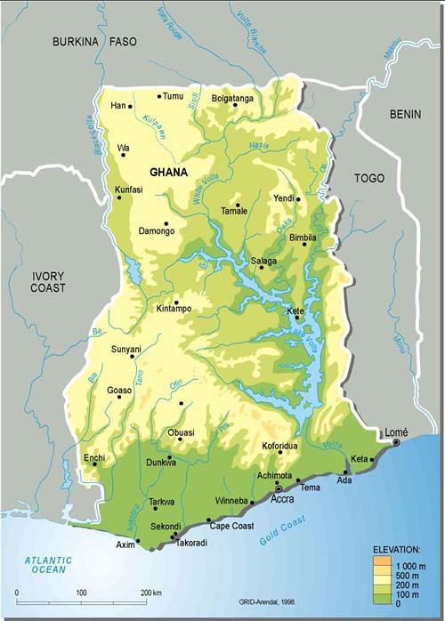
Ghana, topographic map

Overview of the western African country of Ghana, with topography and major cities, as well as lakes and rivers. Ghana is inhabited by 21 million people, and the capital is Accra, on the Atlantic coast. Environmental issues, according to the CIA factbook, are: recurrent drought in north severely affects agricultural activities; deforestation; overgrazing; soil erosion; poaching and habitat destruction threatens wildlife populations; water pollution; inadequate supplies of potable water.

Year: 2005

From collection: Topographic maps

Cartographer: Philippe Rekacewicz, UNEP/GRID-Arendal

Tags: topographic maps

Graphics included in same album

View all media