We use cookies to imporve your experience. By using our site, you consent to our cookie policy Learn more
arrow arrow_up breadcrumb-chevron-right breadcrumb-home dropdown-arrow-down loader GALogoWUNEP GALogo2018 GALogo2019 menu read-more-plus rrss-email rrss-facebook rrss-flickr rrss-instagram rrss-linkedin rrss-twitter rrss-vimeo rrss-youtube rrss_google_plus rrss_skype rrss_web pdf search share Completed In Process Ideas In Develpment Toogle Toogle Thumbnail View List View play close filter-collapse filter edit media_photo_library media_video_library graphics pictures videos collections next

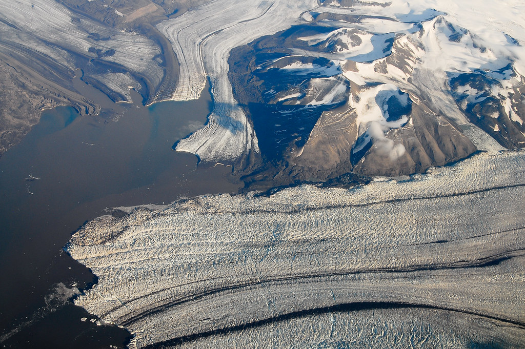
Glacier mouth, Svalbard

Glaciers cover around 59% of Svalbard, which is made up of four islands, Spitsbergen, Nordaustlandet, Edgerøya and Barentsrøya. Many of the glaciers in this area are known to surge, meaning that for 100 years they can remain still and silent, only to suddenly and violently move, advancing from the upper area of the glacier towards the mouth.

Year: 2015

From album: Sea Ice, Icebergs, Glaciers, Snow and Permafrost in the Arctic Region

Photographer: Peter Prokosch

Tags: Arctic Norway

Photos included in same album

View all media