The decrease of Arctic sea ice, minimum extent in 1982 and 2007, and climate projections [Norwegian]
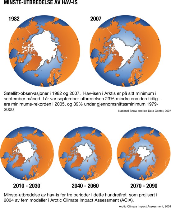
Satellite observations of the September extent of sea ice in the Arctic shows in 2007 shows a 23% decrease from the previous minimum, in 2005, and 39% below the average minimum extent for the time period 1979-2000. The bottom part of this graphic shows the development according to the Arctic Climate Impact Assessment (ACIA) and the merging of five global climate models - the resultant projections shows successive decreases for this century. The Arctic sea ice represents a habitat for wildlife, a climate change indicator and an important factor in the global circulation systems.
Year: 2005
From collection: General Archive
Cartographer: Hugo Ahlenius, UNEP/GRID-Arendal