We use cookies to imporve your experience. By using our site, you consent to our cookie policy Learn more
arrow arrow_up breadcrumb-chevron-right breadcrumb-home dropdown-arrow-down loader GALogoWUNEP GALogo2018 GALogo2019 menu read-more-plus rrss-email rrss-facebook rrss-flickr rrss-instagram rrss-linkedin rrss-twitter rrss-vimeo rrss-youtube rrss_google_plus rrss_skype rrss_web pdf search share Completed In Process Ideas In Develpment Toogle Toogle Thumbnail View List View play close filter-collapse filter edit media_photo_library media_video_library graphics pictures videos collections next

Above-ground carbon-stock density changes

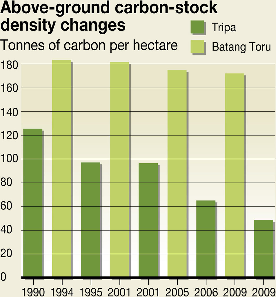
In Batang Toru, land use changes and deforestation led to an overall loss of around 10 tonnes of carbon per hectare between 1994 and 2009. Due to its exploitation for the cultivation of oil palm, the peat area of Tripa had to face a much more important decrease of 66 tonnes of carbon per hectare in the time period 1990-2009. In terms of CO2 emissions, it corresponds to an overall emission per year of 634,903 tCO2.

Year: 2011

From collection: Orangutans and the Economics of Sustainable Forest Management in Sumatra

Cartographer: Riccardo Pravettoni, UNEP/GRID-Arendal

Graphics included in same album

View all media