We use cookies to imporve your experience. By using our site, you consent to our cookie policy Learn more
arrow arrow_up breadcrumb-chevron-right breadcrumb-home dropdown-arrow-down loader GALogoWUNEP GALogo2018 GALogo2019 menu read-more-plus rrss-email rrss-facebook rrss-flickr rrss-instagram rrss-linkedin rrss-twitter rrss-vimeo rrss-youtube rrss_google_plus rrss_skype rrss_web pdf search share Completed In Process Ideas In Develpment Toogle Toogle Thumbnail View List View play close filter-collapse filter edit media_photo_library media_video_library graphics pictures videos collections next

Seagrasses from above - drones and satellites

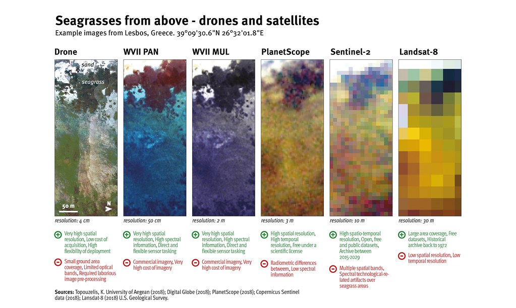
Satellite-based remote sensing can identify and map seagrass with satisfactory detail and frequency to maximum water depths of 40 m in many, but not all, cases, depending on water clarity. The final decision on selecting the appropriate satellite sensor highly depends on the scope of the project (scale and extent), spatial and temporal capabilities of the sensors and the available funds.

Year: 2020

From collection: Out of the Blue - Maps & Graphics from the report

Cartographer: Levi Westerveld

Tags: seagrass

Graphics included in same album

View all media

Publications it appears in

View all publications