We use cookies to imporve your experience. By using our site, you consent to our cookie policy Learn more
arrow arrow_up breadcrumb-chevron-right breadcrumb-home dropdown-arrow-down loader GALogoWUNEP GALogo2018 GALogo2019 menu read-more-plus rrss-email rrss-facebook rrss-flickr rrss-instagram rrss-linkedin rrss-twitter rrss-vimeo rrss-youtube rrss_google_plus rrss_skype rrss_web pdf search share Completed In Process Ideas In Develpment Toogle Toogle Thumbnail View List View play close filter-collapse filter edit media_photo_library media_video_library graphics pictures videos collections next

East Africa region

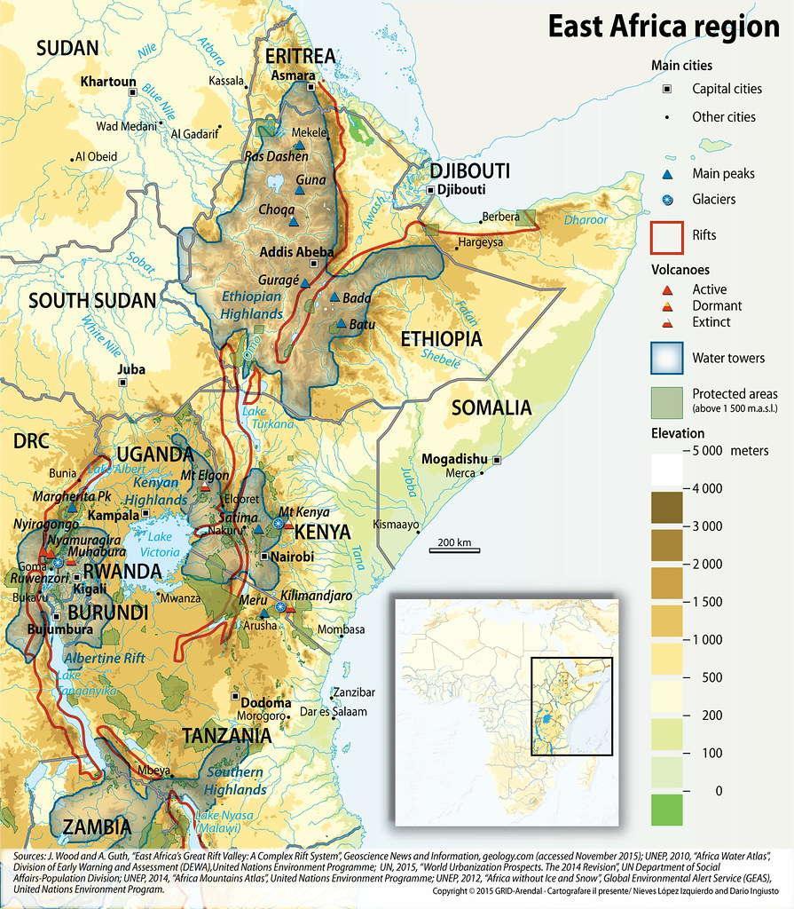
The majority of countries in Africa have land that is over 1,500 m above sea level, and therefore classified as mountainous (UNEP 2014). East Africa is home to some of Africa’s most prominent mountains, including Mount Kilimanjaro, Rwenzori, Virunga, Kenya and Elgon, as well as highland regions such as the Ethiopian Highlands and the East Africa Arc. The Congo Nile Ridge,which runs from Bujumbura and southwestern Rwanda and stretches to the Northern Volcano Massif. The East Africa Rift Valley is also a major geological feature of East Africa.

Year: 2016

From collection: Sustainable Mountain Development in East Africa in a Changing Climate

Cartographer: Nieves Lopez Izquierdo

Tags: Caucasus

Graphics included in same album

View all media

Publications it appears in

View all publications

Related activities

View all activities