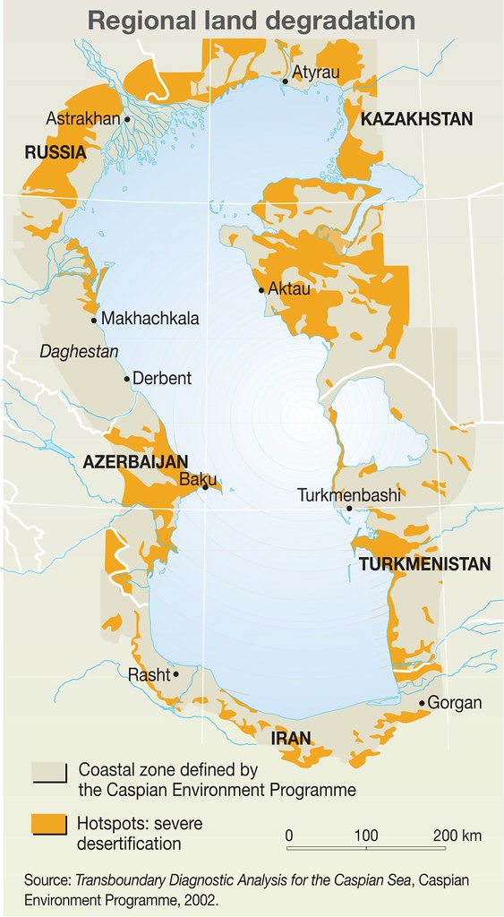
Regional land degradation
Climate change has increased the frequency and intensity of weather-related events and natural disasters such as floods, droughts, landslides, avalanches, debris flows and mud flows. For example, in the last 30 years mudflows in the Terek river basin in the north-eastern Caucasus have occurred almost annually. The most destructive mudflows were recorded in 2000 and were perhaps linked to persistent above-average summer temperatures. In September 2002 the Kolka glacier near Mount Kazbek, the highest peak in the eastern Caucasus, collapsed. The water which had accumulated inside and below the glacier triggered an avalanche that traveled more than 24 kilometres at very high speed killing over 120 people. In 2003 a flood in the Ismayilli-Gobustan region of Azerbaijan affected 31 500 people.
Year: 2012
From collection: Vital Caspian Graphics 2 - Opportunities, Aspirations and Challenges, 2012
Cartographer: Philippe Rekacewicz (le Monde Diplomatique) assisted by Laura Margueritte and Cecile Marin, later updated by Riccardo Pravettoni (GRID-Arendal), Novikov, Viktor (Zoi Environment Network)