Annual discharge into the Caspian Sea
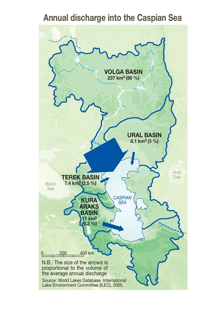
Most of the water flowing into the sea comes from coastal rivers – currently supplying 300 to 310 km3 a year. The Volga alone accounts for 80% of inflow. But it has dropped substantially during the 20th century, declining from about 400 km3 in the 1920-30s to from 260 to 270 km3 at present, due to various climatic factors and human activities such as dams built for hydroelectric energy production. Rainfall over the sea itself is estimated to contribute 130 km3 a year. Water loss through infiltration into the ground accounts for less than 5 km3 and flow into the Kara Bogaz Gol gulf about 18 km3, since the destruction of the dyke. Natural evaporation from the sea is estimated to cause a loss of between 350 and 375 km3 a year. Combining these estimates for water input (about 440 km3) and loss (about 373 km3) suggests that the water level in the Caspian Sea should still be rising.
Year: 2012
From collection: Vital Caspian Graphics 2 - Opportunities, Aspirations and Challenges, 2012
Cartographer: Philippe Rekacewicz (le Monde Diplomatique) assisted by Laura Margueritte and Cecile Marin, later updated by Riccardo Pravettoni (GRID-Arendal), Novikov, Viktor (Zoi Environment Network)