Hydrological charateristics of the HKH region: Selected upper river basins of the HICAP study
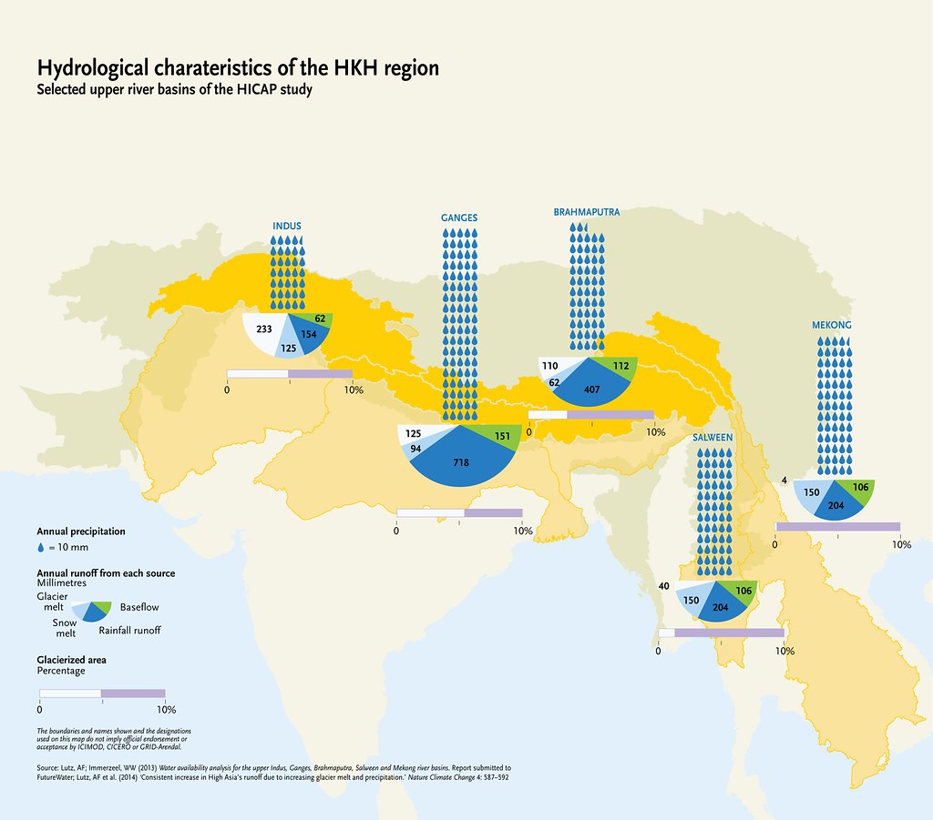
The rivers flowing from the Hindu Kush Himalayas provide the region with one of the most valuable resources: fresh water. Ten large Asian river systems originate in the HKH – the Amu Darya, Brahmaputra (Yarlungtsanpo), Ganges, Indus, Irrawaddy, Mekong (Lancang), Salween (Nu), Tarim (Dayan), Yangtse (Jinsha) and Yellow River (Huanghe). These ten river basins cover an area of 9 million km2, of which 2.8 million km2 fall in the Hindu Kush Himalayan region. Downstream, millions of people depend on the waters from these rivers for domestic use, agriculture, hydropower and industry. The rivers are fed by rainfall, meltwater from snow and ice, and groundwater. The amount of water from each source varies by river. It also varies depending on the location within each basin. The boundaries and names shown and the designations used on this map do not imply official endorsement or acceptance by ICIMOD, CICERO or GRID-Arendal.
Year: 2015
From collection: The Himalayan Climate and Water Atlas
Cartographer: Riccardo Pravettoni