Cereal productivity in sub-Saharan Africa under a projected Intergovernamental Panel on Climate Change (IPCC) scenario
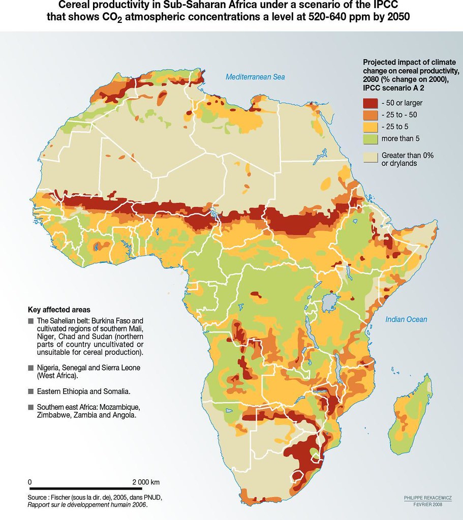
A majority of the population in sub-Saharan African lives in rural areas, where income and employment depend almost entirely on rain-fed agriculture. This population is today at high risk. Sub-Saharan Africa already has a highly variable and unpredictable climate and is acutely vulnerable to floods and droughts. A third of the people in the region live in drought-prone areas, and floods are a recurrent threat in several countries. With climate change, large parts of the region will become drier, increasing the number of people at risk of hunger and poverty by tens of millions. Climate change is already affecting the region. Reduced rainfall across the Sahel, an increase in the incidence of drought and greater volatility are among the current symptoms. But the future points to far more extreme changes: warming between 0.2°C and 0.5°C per decade, with 10% less rainfall in interior regions under intermediate global warming scenarios, and water losses increased by rising temperatures. The warming will be greatest over the semi-arid margins of the Sahara, along the Sahel and interior areas of southern Africa. Climate-induced changes to crop yields and ecosystem boundaries will dramatically affect some of the poorest people in sub-Saharan Africa partly because many of them live in areas most prone to extreme climate events and partly because they have little capacity to adapt by turning to irrigated agriculture, improved seeds or alternative livelihoods. Recent modeling has provided important insights that should serve as an early warning system. One illustration, shown on the map, is based on evidence of the relationship between water availability and productivity in the cereals sector. It highlights areas of acute threat, including a wide band across the Sahel region, stretching from Mauritania across Niger, Burkina Faso, Chad and Sudan. Large swathes of southern Africa face the prospect of steep declines in yields, along with chronically food-insecure countries such as Ethiopia and Somalia. (UNDP Human Development Report, 2006).
Year: 2009
From collection: Vital Water Graphics 2
Cartographer: Philippe Rekacewicz, February 2006