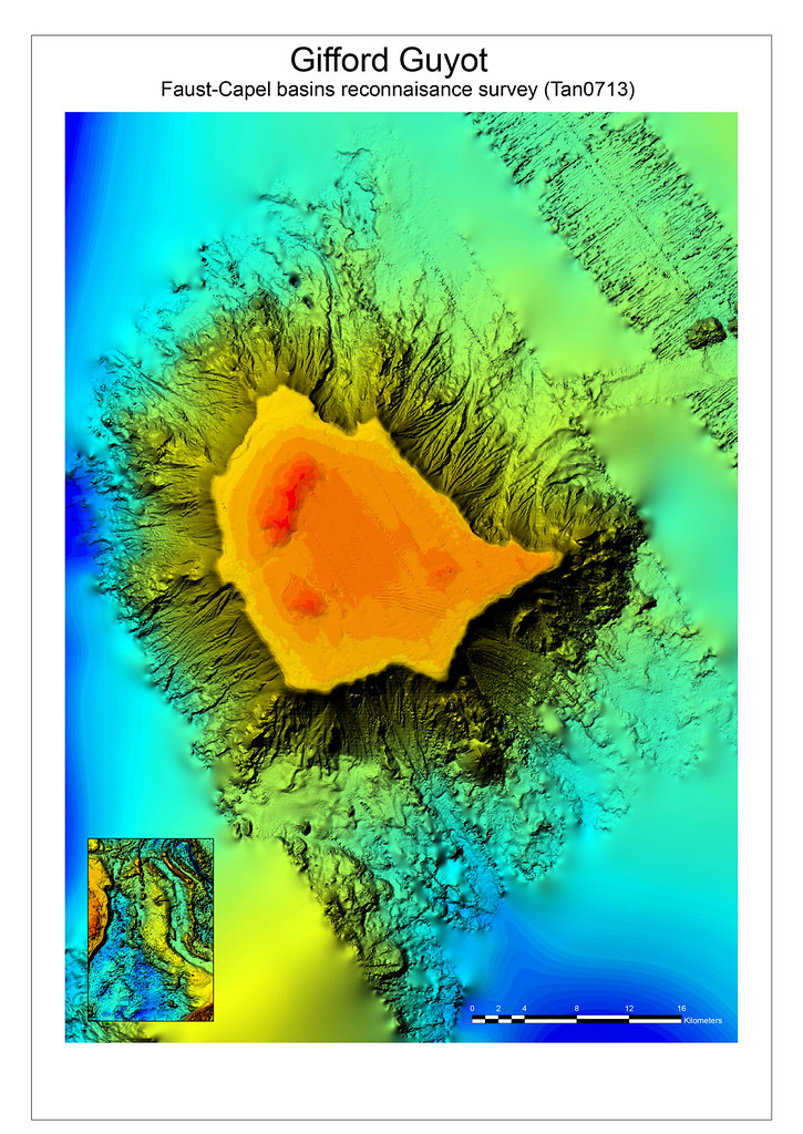
Gifford Guyot, Tasman Sea, southwest Pacific Ocean
This multibeam sonar image was collected in 2007 aboard the RV Tangaroa during a Geoscience Australia marine survey. The flat top of the guyot is about 250 m deep.
Year: 2013
From collection: Deep Sea Minerals Volume 1C
Cartographer: GRID-Arendal