Mount Elgon
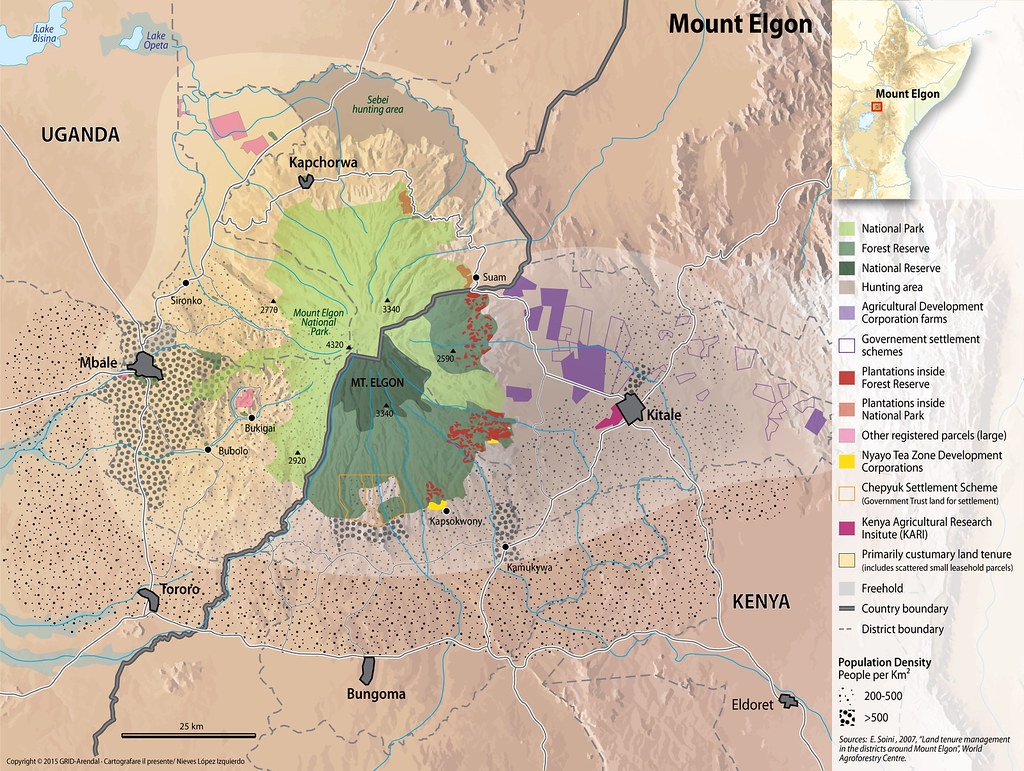
Mount Elgon is shared between Uganda and Kenya and stands at a height of about 4,000 metres above sea level (MoWE, 2013). In Uganda, Mount Elgon National Park covers nearly 1,121 km² of the mountain’s 4,000 km² area (UWA, 2009a). The mountain was listed as a UNESCO Biosphere Reserve in 2005 due to its considerable plant diversity, including several rare species of Afromontane flora, its cultural significance and role as a water catchment area (UWA, 2009a). Apart from being one of the most important areas of biodiversity and a water tower for both Uganda and Kenya, Mt. Elgon also serves as a catchment area for the drainage systems of three lakes - Victoria, Turkana and Kyoga (MoWE, 2013). Mount Elgon’s Afromontane forests provide a range of foods, fibres and fodder for the people living around the mountain area, including the Benet Ndorobo people (Ongugo et. al., 2014).
Year: 2012
From collection: Sustainable Mountain Development in East Africa in a Changing Climate
Cartographer: Nieves Lopez Izquierdo