Possible oil slicks detected by satellites
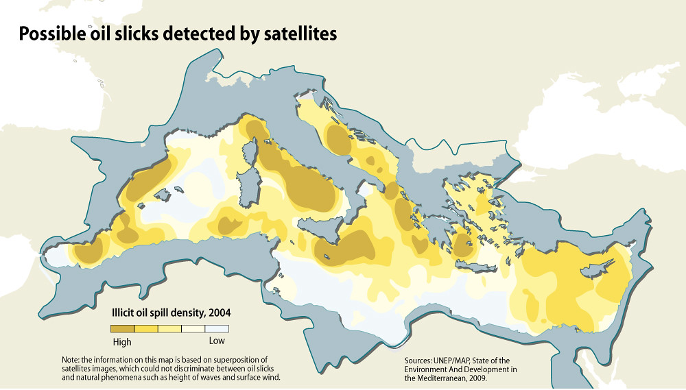
Illicit vessel discharges can be detected using satellite images, allowing the estimation of the spatial distribution of oil-spill density and the identification of hot spots (Abdulla and Linden 2008). This provides evidence that the distribution of oil spills is correlated with the major shipping routes, along the major west-east axis connecting the Straits of Gibraltar through the Sicily Channel and the Ionian Sea with the different distribution branches of the Eastern Mediterranean, and along the routes toward the major discharge ports on the northern shore of the Adriatic Sea, east of Corsica, the Ligurian Sea and the Gulf of Lion (Abdulla and Linden 2008).
Year: 2013
From collection: State of the Mediterranean Marine and Coastal Environment
Cartographer: GRID-Arendal