We use cookies to imporve your experience. By using our site, you consent to our cookie policy Learn more
arrow arrow_up breadcrumb-chevron-right breadcrumb-home dropdown-arrow-down loader GALogoWUNEP GALogo2018 GALogo2019 menu read-more-plus rrss-email rrss-facebook rrss-flickr rrss-instagram rrss-linkedin rrss-twitter rrss-vimeo rrss-youtube rrss_google_plus rrss_skype rrss_web pdf search share Completed In Process Ideas In Develpment Toogle Toogle Thumbnail View List View play close filter-collapse filter edit media_photo_library media_video_library graphics pictures videos collections next

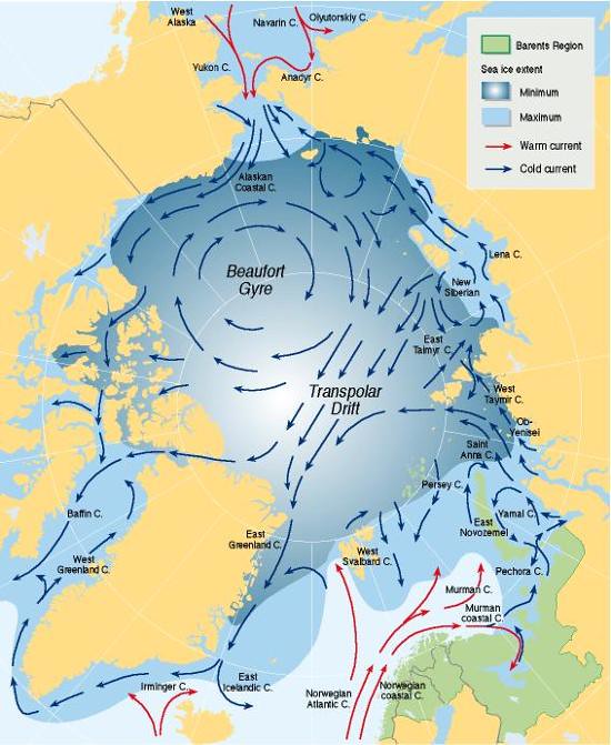
Ocean currents and sea ice extent

Arctic Ocean circulate in a large clockwise rotational pattern moving from east to west around the polar ice cap. This rotating pattern, known as a gyre, occurs as a result of the clockwise winds that typically occur in this region. The Barents region is affected by this and the ice edge extent in the Arctic.

Year: 2005

From collection: Barentswatch Atlas

Cartographer: Philippe Rekacewicz

Tags: Barents Maps Northern Scandinavia sea

Graphics included in same album

View all media