We use cookies to imporve your experience. By using our site, you consent to our cookie policy Learn more
arrow arrow_up breadcrumb-chevron-right breadcrumb-home dropdown-arrow-down loader GALogoWUNEP GALogo2018 GALogo2019 menu read-more-plus rrss-email rrss-facebook rrss-flickr rrss-instagram rrss-linkedin rrss-twitter rrss-vimeo rrss-youtube rrss_google_plus rrss_skype rrss_web pdf search share Completed In Process Ideas In Develpment Toogle Toogle Thumbnail View List View play close filter-collapse filter edit media_photo_library media_video_library graphics pictures videos collections next

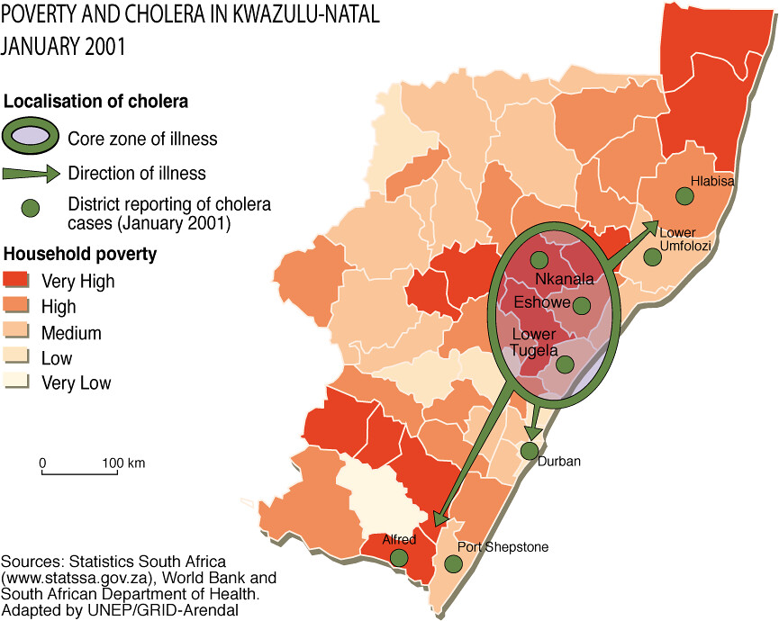
Poverty and cholera in Kwazulu-Natal January 2001

Data and maps on poverty, sanitation, safe and clean water and the incidence of cholera were used to help contain the spread of cholera in the Kwazulu Natal province in January 2001. Poverty and cholera data sets showed that the cholera outbreak followed a river flood plain and moved through and towards poor areas.

Year: 2007

From collection: Environment and Poverty Times #1: WSSD issue

Cartographer: Philippe Rekacewicz, UNEP/GRID-Arendal

Graphics included in same album

View all media