Vulnerability of large cities to climate hazards
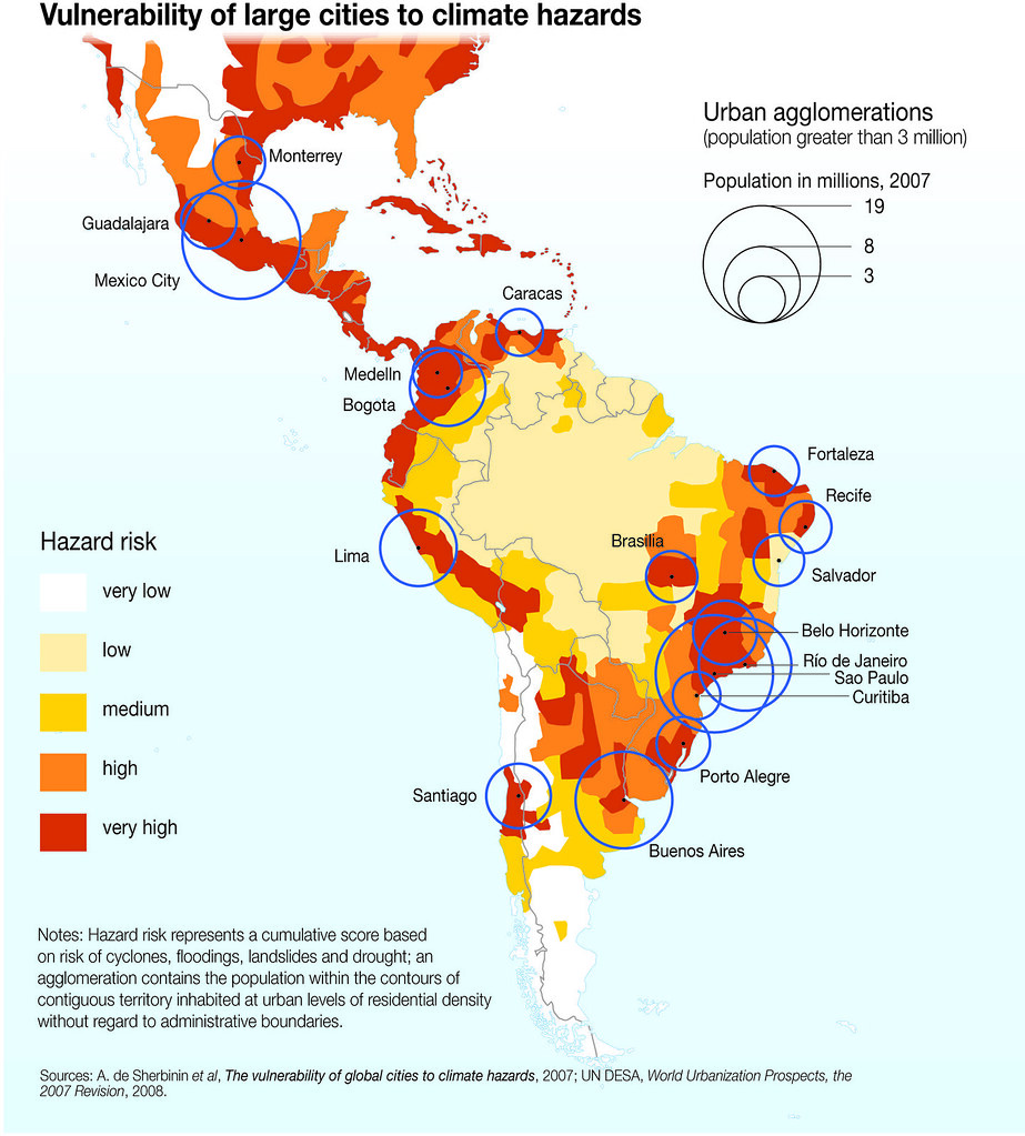
The effects climate change has on different countries are not proportional to their respective contributions to greenhouse gas emissions. Rather, they vary greatly and in some cases the effects may even be positive in specific regions. This presents a general paradox: the countries that are the highest emitters suffer less impact, while those that are lower emitters experience the greatest impact. Metropolitan areas in the region are experiencing different levels of risk as a result of extreme events such as cyclones, floods and droughts. Owing to their location, the cities of Central America, the Caribbean and Mexico, as well as those in central and western Colombia and the coastal areas of eastern Argentina and Brazil, are the most vulnerable to climate hazards.
Year: 2010
From collection: Vital Climate Change Graphics for Latin America and the Caribbean (2010)
Cartographer: Nieves López Izquierdo (Associate Consultant UNEP/GRID-Arendal)