Groundwater Pollution by Canal Seepage in Hat Yai, Southern Thailand
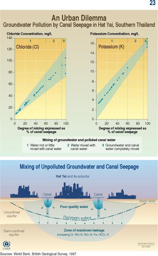
In areas where surface water is not readily available (located far away from areas where it is needed), groundwater is the primary water source. This graphic shows the chloride concentration and the potassium concentration, in milligrams per litre, in the city of Hat Yai's canals. It also shows the degree to which the polluted canal water has mixed with the groundwater. Finally, the graphic explains how the city's groundwater has been polluted by chloride and potassium from the city's canals.
Year: 2005
From collection: Vital Water Graphics
Cartographer: Philippe Rekacewicz, Delphine Digout, UNEP/GRID-Arendal