We use cookies to imporve your experience. By using our site, you consent to our cookie policy Learn more
arrow arrow_up breadcrumb-chevron-right breadcrumb-home dropdown-arrow-down loader GALogoWUNEP GALogo2018 GALogo2019 menu read-more-plus rrss-email rrss-facebook rrss-flickr rrss-instagram rrss-linkedin rrss-twitter rrss-vimeo rrss-youtube rrss_google_plus rrss_skype rrss_web pdf search share Completed In Process Ideas In Develpment Toogle Toogle Thumbnail View List View play close filter-collapse filter edit media_photo_library media_video_library graphics pictures videos collections next

Glacier distribution, surface area and altitude in the Andes

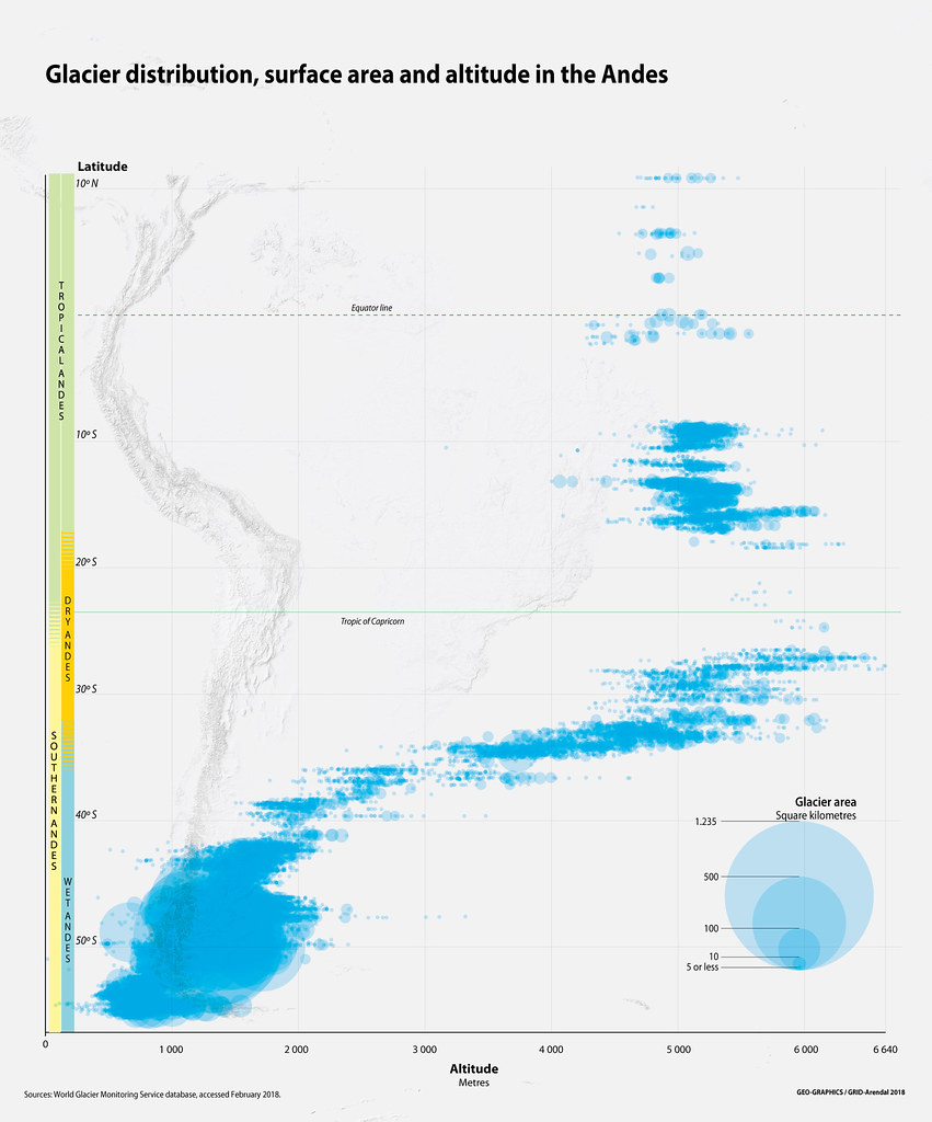
In the Andes, glaciers only form above the snowline, where snow persists throughout the year. Their formation depends on latitude, altitude, and annual precipitation. As snow accumulates it compresses the underlying snow, creating a layer of dense snow, called a firn. As the snow continues to accumulate the pressure increases, further compacting the firn, which develops into solid glacier ice. When this ice gets thick enough the glacier begins to flow, due to the force of its own mass under gravity, either by sliding or internal deformation.

Year: 2019

From collection: The Andean Glacier and Water Atlas

Cartographer: Riccardo Pravettoni

Tags: Andes atlas

Graphics included in same album

View all media

Publications it appears in

View all publications

Related activities

View all activities